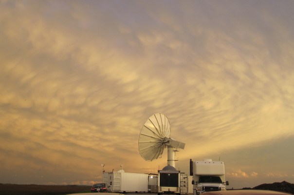
NASA’s NPOL radar in late May, located south of Waterloo, Iowa, under a large anvil cloud with mammatus clouds. Copyright Brenda Dolan, Colorado State University.
If you want to study rainfall and floods to help improve satellite predictions of both, you couldn’t choose a better place this year than Iowa.
But Witold Krajewski and the researchers at the University of Iowa’s Iowa Flood Center didn’t know that last year, when they planned the project with NASA’S Goddard Space Flight Center.
Krajewski, the flood center’s director, was persuading NASA to base its study in Iowa because the state has no mountains and sea coasts, which sometimes make it difficult for radar to distinguish rainfall from other things. “We do have floods,” Krajewski says he told the NASA collaborators. “I wasn’t wishing for a flood, but I was saying this when we were in a drought.”
NASA took a chance, despite 2012’s dry weather, and it’s paid off with a rush of data that’s expected to improve computer forecast models’ ability to predict flooding. The study’s observational phase wraps up this week, after employing some powerful radar and a small army of rain gauges and soil moisture sensors.